
Table of Contents
Fog imaging has become an important field wherever visibility, safety, and decision-making depend on seeing through atmospheric haze. It refers to the use of specialized sensors, optics, algorithms, and image-processing techniques to capture usable visual information in fog, mist, smoke, or other scattering conditions. Although it is often associated with transportation and surveillance, its value extends into healthcare, environmental monitoring, industrial automation, maritime navigation, and scientific research.
TLDR: Fog imaging uses advanced cameras, sensors, and software to improve visibility in foggy or hazy environments. It combines technologies such as thermal imaging, LiDAR, radar, and AI-based image enhancement. Its real-world applications include safer roads, smarter vehicles, maritime navigation, airport operations, security, and environmental monitoring.
What Is Fog Imaging?
Fog imaging is the process of capturing, enhancing, and interpreting images when visibility is reduced by suspended water droplets or particles. In normal conditions, a camera records light reflected from objects. In fog, however, light is scattered before it reaches the lens, reducing contrast and making distant objects appear washed out or invisible.
To overcome this problem, fog imaging systems may use alternative wavelengths, advanced sensors, computational models, or multiple sources of data. Instead of relying only on visible light, these systems may combine visible cameras with infrared sensors, radar, or LiDAR. The goal is not always to create a perfectly clear photograph, but to extract enough reliable information for a person or machine to make a safe decision.
In practical terms, fog imaging transforms poor-visibility environments into readable data. A driver assistance system may identify a pedestrian before the human eye can. A ship may detect a buoy or nearby vessel in a misty harbor. A security camera may distinguish between natural fog and movement near a restricted facility.
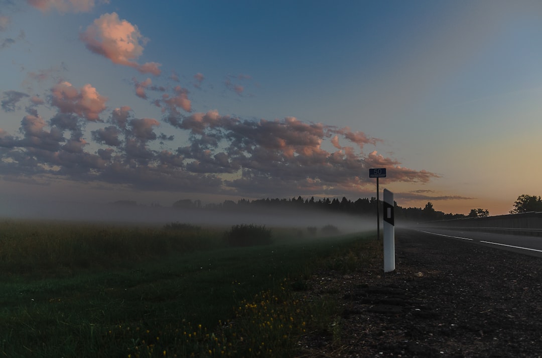
Why Fog Is Difficult for Imaging Systems
Fog creates a unique challenge because it does not simply darken a scene. It scatters light in many directions, causing several problems at once:
- Reduced contrast: Objects blend into the background, especially at long distances.
- Light backscatter: Light reflects off fog droplets and returns to the camera, creating glare.
- Loss of depth cues: Distance becomes harder to estimate because edges and shadows fade.
- Color distortion: Scenes often appear gray, blue, or washed out.
- Sensor noise: Cameras may increase sensitivity in low visibility, which can introduce grain or false details.
These effects make fog imaging more complex than ordinary low-light photography. A dark night can often be improved with more illumination, but shining a bright light into fog may worsen visibility by increasing reflected glare. For this reason, fog imaging often requires carefully selected wavelengths and intelligent processing rather than simple brightness enhancement.
Core Technologies Behind Fog Imaging
1. Infrared and Thermal Imaging
Infrared imaging captures light beyond the visible spectrum. Some infrared wavelengths can perform better than visible light in haze or fog, depending on droplet size and atmospheric conditions. Thermal imaging, a related technology, detects heat emitted by objects rather than reflected light.
This makes thermal cameras especially useful for detecting people, animals, engines, machinery, or vehicles in low-visibility environments. In a foggy scene, a person may be difficult to see with a normal camera but may appear clearly as a warm shape in a thermal image. However, thermal imaging has limitations. It may not show fine visual details, text, road markings, or color, so it is often combined with other imaging methods.
2. LiDAR
LiDAR, short for Light Detection and Ranging, uses laser pulses to measure distance and create three-dimensional maps. It is widely used in autonomous vehicles, robotics, surveying, and infrastructure monitoring. In fog, LiDAR performance can be affected because droplets scatter the laser beam, creating noise and reducing range.
Even so, advanced LiDAR systems can filter out some fog-related interference through signal processing. By analyzing the timing, strength, and pattern of returning signals, the system may distinguish between true objects and atmospheric particles. Short-range LiDAR can be especially useful for detecting nearby obstacles when visibility is poor.
3. Radar Imaging
Radar uses radio waves rather than visible light. Because radio waves are less affected by fog, dust, rain, and darkness, radar is a powerful tool for all-weather detection. Automotive radar can identify the speed and distance of vehicles ahead, while maritime radar helps ships navigate through foggy waterways.
Radar does not usually produce images as visually intuitive as a camera, but it provides dependable information about object location and movement. In modern fog imaging systems, radar often acts as a safety layer, confirming or supplementing data from cameras and LiDAR.
4. Polarization Imaging
Polarization imaging analyzes the orientation of light waves. Since scattered light in fog often has different polarization properties from light reflected by objects, polarization filters and sensors can help improve contrast. This technique is valuable in research, machine vision, and some surveillance applications.
It may not completely eliminate fog, but it can reveal structures that are otherwise difficult to see. With the right algorithms, polarization imaging can separate useful object information from scattered atmospheric light.
5. Computational Dehazing and AI Enhancement
Much of modern fog imaging depends on software. Computational dehazing uses mathematical models to estimate how fog affects an image and then reconstructs a clearer version. Traditional dehazing methods may analyze contrast, brightness, depth, and atmospheric light.
More recently, artificial intelligence and deep learning have improved image restoration. AI models can be trained on large datasets of clear and foggy scenes, learning how to recover edges, identify objects, and enhance visibility. These systems are used in autonomous driving, security monitoring, aerial imaging, and mobile photography.
However, AI enhancement must be handled carefully. In safety-critical environments, an algorithm should not invent details that are not actually present. Reliable fog imaging depends on accuracy, not just visual appeal.
Common Uses of Fog Imaging
Transportation and Driver Safety
One of the most important uses of fog imaging is road safety. Fog can cause multi-vehicle collisions because drivers fail to see stopped cars, pedestrians, sharp turns, or road barriers in time. Advanced driver assistance systems use cameras, radar, thermal sensors, and AI to detect hazards beyond normal human visibility.
In vehicles, fog imaging may support:
- Forward collision warning
- Automatic emergency braking
- Lane detection in low visibility
- Pedestrian and animal detection
- Adaptive cruise control
Autonomous vehicles rely even more heavily on these technologies. Since a self-driving system must understand its surroundings under many weather conditions, fog imaging is essential for robust perception.
Aviation and Airport Operations
Fog can disrupt airports by reducing runway visibility and delaying takeoffs or landings. Imaging systems support ground traffic control, runway monitoring, aircraft docking, and perimeter security. Enhanced cameras, infrared sensors, and radar systems help airport personnel detect vehicles, aircraft, wildlife, and obstacles in foggy conditions.
Although pilots depend on instruments rather than cameras alone, improved imaging can assist ground operations and reduce delays. In some airports, automated visibility monitoring systems provide real-time data to support safer scheduling and routing.
Maritime Navigation
Ships, ferries, and port authorities have long struggled with fog. Maritime fog imaging often combines radar, thermal cameras, visible-light cameras, and electronic navigation systems. These technologies help detect coastlines, buoys, docks, small boats, and floating hazards.
Image not found in postmetaThermal imaging is particularly useful for search and rescue. A person in cold water may be difficult to locate visually, but a thermal camera can reveal heat signatures against the cooler surroundings. Ports also use fog imaging for surveillance, traffic control, and cargo security.
Security and Surveillance
Security systems must operate in many environmental conditions, including fog, rain, dust, and smoke. Fog imaging helps monitor borders, industrial sites, utilities, military facilities, and transportation hubs. Thermal cameras can detect intruders, while AI-enhanced video analytics can identify movement patterns even when contrast is low.
In critical infrastructure, reliability matters more than image beauty. A surveillance system may not need a perfect image of a face in fog, but it must reliably detect whether a person, vehicle, or drone has entered a restricted area.
Environmental Monitoring
Fog imaging also supports environmental and climate research. Scientists study fog formation, density, movement, and interaction with landscapes. In regions where fog provides an important water source, such as coastal deserts and mountain ecosystems, imaging helps researchers track fog patterns and estimate moisture availability.
Remote cameras and satellite imaging can monitor haze, wildfire smoke, and air pollution. Although smoke and fog differ physically, many imaging challenges are similar because both scatter light and reduce visibility.
Industrial and Robotic Applications
Factories, mines, warehouses, and outdoor industrial sites may experience mist, steam, vapor, or dust that behaves like fog from an imaging perspective. Robots and automated machines need dependable vision to inspect equipment, navigate safely, and detect defects.
Fog imaging techniques are useful in:
- Mining vehicles operating in dust or mist
- Food processing plants with steam-filled areas
- Automated inspection in humid environments
- Robots working in tunnels, ports, or cold storage facilities
By improving machine perception, fog imaging reduces downtime, increases safety, and supports automation in difficult environments.
Real-World Application: Smart Cities
Smart cities increasingly use networks of cameras and sensors to manage traffic, public safety, energy systems, and emergency response. In fog-prone regions, standard cameras may fail during some of the most dangerous conditions. Fog imaging can improve traffic signal control, accident detection, bridge monitoring, and emergency vehicle routing.
For example, a city traffic system may use visibility sensors and enhanced cameras to detect congestion on a foggy highway. If visibility drops, the system can automatically reduce speed limits, activate warning signs, and alert maintenance or emergency teams. Combined with vehicle-to-infrastructure communication, fog imaging becomes part of a broader safety ecosystem.
Benefits and Limitations
The benefits of fog imaging are significant. It can improve safety, reduce accidents, support automation, assist rescue operations, and provide valuable environmental data. It also allows machines to function in conditions that would otherwise limit human vision.
Still, fog imaging has limitations. Dense fog can reduce the performance of nearly all optical systems. Thermal cameras may fail to show important surface details. Radar may lack fine image resolution. LiDAR may experience scattering. AI systems may produce errors if trained on incomplete or unrealistic data.
For this reason, the most reliable systems use sensor fusion. Instead of depending on one technology, they combine multiple data sources. A camera may provide visual detail, radar may confirm distance and speed, LiDAR may map nearby structures, and thermal imaging may detect living beings. Together, these tools create a more dependable understanding of the scene.
The Future of Fog Imaging
The future of fog imaging will likely be shaped by better sensors, faster processors, and more trustworthy AI. Autonomous vehicles, drones, smart infrastructure, and robotic systems will require perception technologies that work in all weather. Researchers are also developing improved dehazing algorithms, advanced infrared sensors, and compact imaging systems that can be deployed at scale.
As costs fall, fog imaging may become common in consumer vehicles, smartphones, security cameras, and public infrastructure. Its role will continue to expand wherever visibility affects safety, productivity, or environmental awareness.
Conclusion
Fog imaging is more than a specialized camera technique; it is a collection of technologies designed to interpret the world when visibility is compromised. By combining optics, sensors, radar, LiDAR, thermal imaging, and AI, these systems provide critical information in environments where ordinary vision fails. From highways and harbors to airports, factories, and smart cities, fog imaging is becoming an essential part of modern safety and automation.
FAQ
What is fog imaging?
Fog imaging is the use of cameras, sensors, and software to capture or enhance visual information in foggy, misty, smoky, or hazy conditions.
Which technology works best in fog?
No single technology is best in every situation. Radar works well for detecting distance and movement, thermal imaging is useful for heat signatures, and AI dehazing can improve camera images.
Can cameras see through dense fog?
Standard cameras usually struggle in dense fog. Specialized systems may improve visibility, but extremely dense fog can still limit imaging performance.
How is fog imaging used in cars?
Vehicles use fog imaging through radar, cameras, thermal sensors, and driver assistance software to detect obstacles, pedestrians, lanes, and other vehicles in poor visibility.
Is AI fog removal always accurate?
AI-based dehazing can be effective, but it is not always perfect. In safety-critical systems, AI results are usually combined with sensor data to reduce errors.
Why is sensor fusion important?
Sensor fusion combines data from multiple technologies, such as cameras, radar, LiDAR, and thermal sensors. This creates a more reliable view than any single sensor could provide alone.